About Lake Rukwa Basin Water Board
The Lake Rukwa Water Basin was established in May, 2004 by the previous Water Utilization (Control and Regulation) Act no. 42 of 1974 and its subsequent amendments Act No. 10 of 1981, Act No. 17 of 1989 and Act No. 8 of 1997. The Basin is an entity of government under the Ministry responsible for water, mandated to manage (protect, develop and allocate) water resources within the basin as stipulated under Water Resources Management Act No. 11 of 2009.
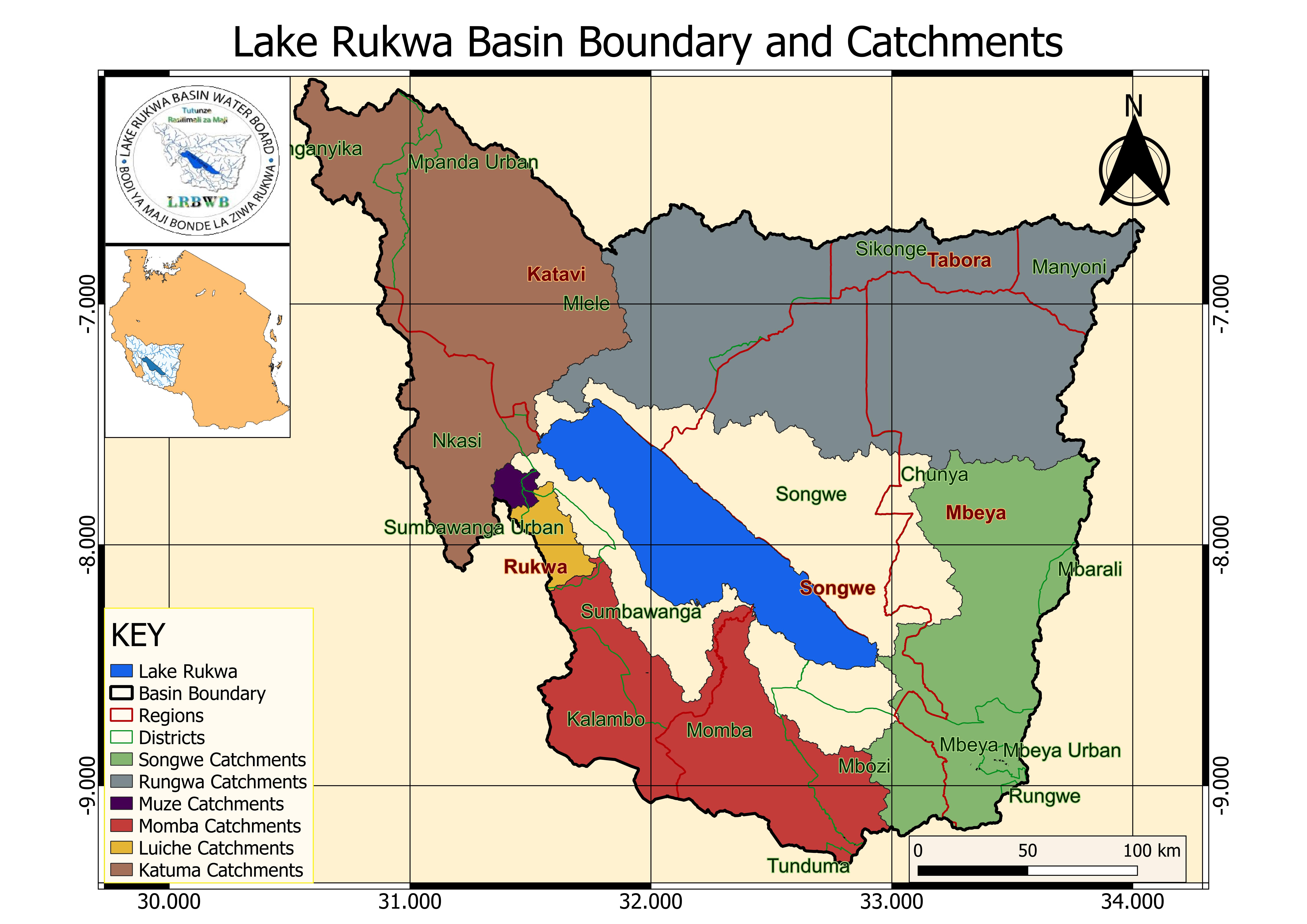
Lake Rukwa Basin is a fairly large basin which comprises parts of the administrative regions of Mbeya, Rukwa, and small parts of Tabora. It is an internal drainage system comprising the lake with a surface area of 2,300 km2.
The Basin borders Lake Tanganyika Basin to the West and North, Zambia country to the South, Lake Nyasa Basin to the South East and Rufiji River Basin to the East. The entire basin has an area of 88,000 km2 with a population of 2.2 million (2002 census) whereas 19% live in urban and 81% live in rural areas. The population is expected to double by the year 2025.